

단일 앵커 강에서 시작하여 강둑을 따라 마을에 머물면서 짧은 셔틀을 위해 인근 철도를 이용하고 저녁에는 돌 제방을 따라 명상적인 산책을 예약하여 2일 루프를 더 쉽게 만들 수 있습니다. 이러한 선택은 여정을 집중적이고 보람 있게 유지합니다.
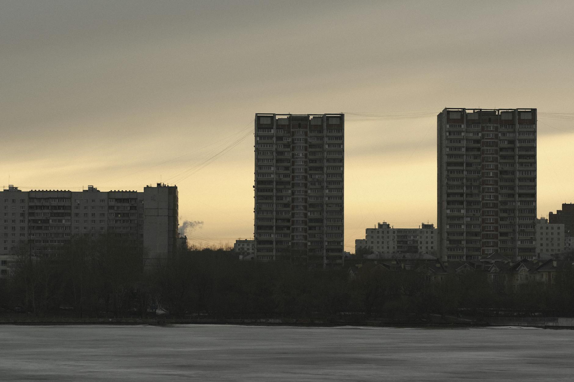
볼가 강은 유럽에서 가장 긴 강으로, 인구 밀도가 높은 회랑을 따라 흐르며 카잔에서 볼고그라드까지 다양한 도시의 모자이크를 포함합니다. 해안선의 갤러리에는 수도원, 박물관 및 돌 제방이 있습니다. 작은 마을 근처의 불가리아 스타일 게스트하우스는 잔잔한 저녁 물 풍경과 간단한 식사를 제공합니다. 주요 하이라이트는 현대까지 지속되는 강둑을 따라 문화가 혼합되어 있다는 것입니다.
레나 강은 광대한 시베리아 지역에 걸쳐 있으며, 거대한 유역과 해빙과 추위가 번갈아 나타나는 기후를 가지고 있습니다. 야쿠츠크와 같은 도시를 통과하는 경로는 계절적이며, 저녁 빛 속에서 타이가가 빛납니다. 유목민 상인에 대한 전설은 소수의 지역 갤러리에 보존되어 있으며, 강 하류를 따라 있는 인구는 희소하여 그 안에 광대한 침묵의 느낌을 담고 있습니다. 짧은 우회를 위해 아르군 계곡은 작은 마을 근처에서 명상적인 달리기 구간을 제공합니다.
예니세이 강은 시베리아 중앙 평야를 가로지르고 북극으로 이어집니다. 크라스노야르스크 근처의 댐은 거대한 수력 발전 용량을 만듭니다. 협곡의 블록 벽은 경로를 구성하고, 전류는 속도를 늦추면 명상적으로 유지됩니다. 문화적 정거장을 원하는 사람들은 강변 마을의 작은 갤러리를 방문하여 이 지역을 형성한 상인과 탐험가의 전설을 추적할 수 있습니다.
오비 강은 시베리아 서부를 통과하여 오비 만으로 흐르며, 하류 삼각주는 튜멘 및 옴스크와 같은 도시를 따라 거대한 인구를 지원합니다. 강을 따라 있는 철도 회랑은 접근을 용이하게 하고, 돌둑가의 저녁은 달리는 배를 하루 종일 탄 후 조용한 성찰을 제공합니다. 마을에서는 불가리아에서 영감을 받은 요리를 맛보고 지역 전설을 배울 수 있습니다. 강은 그 안에 무역과 정착의 깊은 역사를 담고 있습니다.
아무르 강은 중국과의 국경의 넓은 구간을 표시하며, 하류에는 블라고베셴스크와 하바롭스크와 같은 주요 도시가 있습니다. 강은 도시에서 넓은 인구를 포함하고 있지만 조용한 루프는 마을 시골에 남아 있습니다. 인근 철도는 종종 계곡과 평행하게 이어져 저녁 산책과 돌 부두에 빠르게 접근할 수 있습니다. 지역 갤러리는 한때 문화를 연결했던 상인들의 전설 이야기를 보존하고 있으며, 이 국경 지대가 독특한 문화적 혼합을 주최한다는 것을 상기시켜 줍니다.
러시아의 강: 동식물
예니세이 삼각주를 따라 새벽 보트 크루즈를 타고 갈대밭, 수련, 둥지를 짓는 새를 관찰하십시오. 이른 아침 빛은 수생 생물이 강 테라스와 계절적 홍수에 어떻게 의존하는지 명확하게 보여줍니다.
동식물과 서식지는 홍수 패턴, 염도 및 온도에 적응합니다. 범람원 지역에서는 버드나무와 오리나무 숲이 양서류와 곤충의 은신처를 강화하고, 강둑을 따라 있는 빽빽한 갈대밭은 치어와 물새의 은신처를 제공합니다. 바이칼 지역의 강을 따라 차가운 개울은 맑고 산소가 잘 공급된 물을 견디는 다양한 식물을 공급합니다. 섬과 얕은 호수는 수련과 물개구리와 같은 수생 식물이 번성하는 주머니를 만들고, 이끼는 그늘진 후미진 곳의 축축한 돌에 달라붙습니다.
- 버드나무(Salix spp.)와 오리나무(Alnus spp.) 덤불은 낮은 둑을 따라 늘어서 있으며 왜가리, 물총새 및 섭금류의 둥지 자리를 제공합니다.
- 가장자리를 따라 있는 갈대밭(Phragmites australis)은 무척추동물, 양서류 및 저어새를 지원합니다. 또한 전류 흐름을 늦추어 생산적인 가장자리 영역을 형성합니다.
- 수련(Nymphaea spp., Nuphar spp.)은 잔잔한 얕은 곳에 떠 있어 잠자리와 작은 물고기를 끌어들이는 동시에 가장자리에 색을 더합니다.
- 이끼와 우산이끼는 축축한 돌과 개울가 둑을 덮어 무척추동물과 양서류의 미세 서식지를 늘립니다.
- 수생 조류와 거대 조류는 얕은 만에서 매트를 형성하여 달팽이, 올챙이 및 수줍은 물고기 종의 먹이 장소를 만들고, 바이칼 분지는 급격한 변화에 저항하는 독특한 냉수 식물을 특징으로 합니다.
- 동물군에는 동부 강의 강꼬치고기, 농어, 황어, 레녹 및 타이멘과 같은 담수어가 포함됩니다. 철갑상어는 전류가 느려지고 깊이가 증가하는 하류에 자주 나타납니다.
- 조류는 물수리, 흰꼬리수리, 회색 왜가리 및 두루미를 중심으로 합니다. 백조와 오리와 같은 물새는 섬과 호수 근처의 얕은 지역에서 먹이를 찾습니다.
- 수달과 비버는 초목이 무성한 둑을 따라 댐 네트워크를 유지합니다. 숲이 우거진 가장자리를 따라 여우와 작은 포유류가 황혼에 먹이를 찾습니다.
- 관찰하기 가장 좋은 시기는 범람원이 활성화되고 번식지가 보이는 늦봄에서 초여름까지입니다. 만남을 최대화하기 위해 3~5일 경로를 계획하십시오.
- 보트 통행량이 제한된 보호 습지 지역을 제공하는 경로를 선택하십시오. 그곳에서 물가에서 시간을 보내고 깊이 변화와 서식지 패치를 관찰하면서 편안함이 커집니다.
- 둥지로부터의 거리에 대한 지역 지침을 따르고 횃대에 앉는 군집을 방해하지 마십시오. 조용하고 느린 움직임과 최소한의 장비 소음으로 접근 방식을 강화하십시오.
- 장비: 쌍안경, 경량 망원경, 방수 부츠, 통기성 의류 및 소형 카메라. 참조용으로 섬과 호수 클러스터를 보여주는 지도를 휴대하십시오.
- 바이칼 지류를 방문할 계획이라면 더 차가운 물과 변하기 쉬운 조건에 대비하십시오. 그곳에서 생태계는 깨끗하고 진실하게 느껴지며 강 네트워크에 대한 더 깊은 감사를 얻을 수 있습니다.
동식물 관찰을 연결하는 실용적인 경로가 있습니다. 보호된 만 근처에서 시작한 다음 전류 속도가 다른 식물 군집을 형성하는 상류 지류로 밀어 넣습니다. 그곳에서 만남 리듬이 바뀌고 흐름 방향이 종 분포에 미치는 영향을 알 수 있습니다. 물 위에서의 하루를 모든 물보라와 잔물결이 또 다른 생물 다양성 층을 드러내는 살아있는 교실로 생각하십시오. 그 경험은 환상적으로 보이지만 각 정류장이 뚜렷한 서식지 틈새를 강조하면서 명확하고 측정 가능하게 유지됩니다. 때로는 물고기 씨앗 마차가 표류하는 조용한 주머니를 발견하고 삶이 변화하는 깊이에 적응하는 방식에 경이로움을 느낄 것입니다. 그곳에서 저는 물을 듣고 잠자리가 맴도는 것을 지켜보고 빛이 바뀌면서 어떤 종이 늦게 움직이는지 기록하면서 몇 시간을 보냈습니다.
볼가 삼각주: 주요 조류 관찰 명소 및 우세한 습지 식물
강이 넓은 역류로 갈라지는 북쪽 땅에서 시작하십시오. 이 땅은 새벽에 이동성 섭금류, 펠리컨, 왜가리 및 오리가 고농도로 서식하여 집중적인 2일 회로를 위한 가장 강력한 시작을 제공합니다.
대상: 얕은 호수와 주요 지류를 따라 있는 광대한 갈대 벨트에 흩어져 있는 섬 클러스터. 260종 이상이 이곳에서 기록되었으며, 아침과 늦은 오후에는 새들이 횃대와 먹이 장소 사이를 이동하면서 가장 풍부한 활동을 보입니다.
수로의 깊이는 약 0.5~3미터이며, 가장 깊은 주머니는 주요 입 근처의 더 넓은 굴곡을 따라 늘어서 있습니다. 창백한 하늘을 배경으로 실루엣으로 보이는 논병아리, 오리 및 섭금류를 위해 수주를 계속 스캔하십시오. 바위 해안은 드물지만 오래된 흙이 물가와 만나는 곳에서 발생하여 맹금류와 갈매기를 위한 다양한 횃대를 제공합니다.
접근 및 물류: 모스크바에서 출발하는 항공편은 아스트라한으로 연결된 다음 철도 또는 철도를 통해 관문 도시로 연결됩니다. 보트 환승은 섬 네트워크와 역류 구간으로 이동합니다. 가장 좋은 시기는 늦봄에서 초가을까지이며, 얕은 만과 갈대밭이 생명으로 가득 차 있고 강의 흐름이 일상적인 패턴을 정의합니다. 저녁 도시에서는 사우나가 물 위에서 긴 하루를 보낸 후 휴식을 취하는 데 도움이 됩니다.
우세한 습지 식물: 일반 갈대(Phragmites australis)의 광대한 군락이 강 가장자리와 호수 가장자리를 지배하고, Typha latifolia(부들)는 얕은 습지 가장자리를 따라 늘어서 있습니다. Scirpus와 Carex 사초는 더 습한 지역을 채우고 열린 만에는 Nymphaea 수련이 있습니다. 이 식물은 광범위한 거주자와 이주자에게 먹이를 공급하는 무척추동물을 유지합니다. 섬과 조용한 만은 초목 구조가 조류 관찰 결과에 직접적인 영향을 미치는 미세 서식지를 만들어 한적한 횃대와 풍부한 먹이 장소를 제공합니다.
레나 강: 타이가 식물과 강둑 야생 동물 관찰 장소
최고의 야생 동물 관찰을 위해 야쿠츠크 근처 레나 강 위의 나무 전망대에서 새벽에 시작한 다음 타이가 가장자리를 따라 남동쪽으로 강을 따라 얕은 역류가 있는 2~3개의 굴곡을 선택하십시오. 해당 경로를 결정한 후 각 정류장에서 보는 것을 비교할 수 있습니다.
레나 강둑을 따라 있는 식물은 전형적인 타이가 팔레트입니다. 우세한 시베리아 낙엽송, 혼합 가문비나무와 소나무, 자작나무 숲, 범람원을 따라 있는 버드나무-오리나무 가장자리입니다. 늦봄부터 여름까지의 달에는 블루베리와 크랜베리 관목이 가장자리를 채색하고 이끼가 표면에 떨어진 통나무를 덮습니다. 강은 세계에서 가장 긴 강 중 하나이며, 이는 긴 계절에 걸쳐 범람원을 형성하는 사실입니다.
레나를 따라 있는 최고의 관찰 도시인 야쿠츠크, 렌스크, 우스트쿠트, 키렌스크는 접근성과 서비스를 제공합니다. 굴곡을 따라 비버 롯지가 둑을 고정합니다. 수달이 표면에 나타나 바위 사이를 뛰어다닐 수 있습니다. 무스와 불곰을 포함한 더 큰 포유류는 황혼에 범람원 공터 근처에 나타납니다. 해안선에서의 웨딩 사진 촬영조차도 빛이 맞으면 장면의 일부가 될 수 있습니다.
관찰하기 가장 좋은 달은 늦봄부터 초가을까지입니다. 일년에 두 번 이동성 무리가 강을 따라 급증합니다. 표면의 눈부심을 최소화하기 위해 바람 방향과 태양 각도를 고려하고 열린 물을 똑바로 가로지르기보다는 굴곡을 돌십시오. 삼각주 가장자리 관점을 위해 강이 주 수로에서 더 넓은 네트워크로 퍼지는 틱시 지역과 북쪽 입구로 향하십시오.
안전 및 접근: 확립된 트레일만 사용하십시오. 출발하기 전에 홍수 데이터와 지역 지침을 확인하십시오. 에티켓 측면에서 둥지에서 최소 50미터 거리를 유지하십시오. 여기서의 단어는 인내입니다. 비버가 표면에 나타나거나 두루미가 갈대에서 들어올리기를 몇 분 동안 기다릴 수 있습니다. 강의 리듬에 맞춰지면 빛이 바뀌면서 진정으로 친밀한 순간을 목격하게 될 것입니다. 레나는 행성 규모의 강 회랑 내에 위치하고 있으며, 만날 수 있는 가장 큰 담수 광경 중 일부를 주최하고 있으며, 각 굴곡의 표면은 겨울부터 늦여름까지 잊을 수 없는 삶을 종종 드러냅니다.
예니세이 강: 연어 회유와 주변 강변 식생
8월 말에서 9월 초에 도착하여 예니세이 강물을 협상하고 범람원을 따라 무대를 설정하는 최대 수의 연어를 목격하십시오. 평야 내에서 이동 채널은 계절적 홍수와 함께 방향을 바꾸어 물고기를 더 잔잔한 역류와 숨겨진 측면 웅덩이로 안내합니다. 저는 타이밍을 지켜보고 첫 번째 파도가 새벽에 도착한다는 것을 알고 있습니다. 물이 창백한 하늘을 반사할 때 쉽게 발견할 수 있습니다.
강변 식생은 서식지를 형성하는 뚜렷한 층을 형성합니다. 지상층에는 이끼와 풀이 서식합니다. 관목층은 버드나무와 오리나무를 보호합니다. 윗층은 그늘을 드리워 후방 둑을 따라 물을 더 차갑게 유지합니다. 이 명확한 층화는 풍부한 곤충 군집을 지원하며, 이는 산란장으로 이동하는 연어 치어와 돌아오는 성어를 유지합니다.
- 관찰 지점: 주요 수로와 지류 입구를 따라 접근 가능한 트레일을 선택하여 여러 방향으로 회유를 보고 가장자리 웅덩이와 더 깊은 부분을 비교하십시오. 각 지점은 자체 타이밍을 산출합니다.
- 타이밍 및 여행: 단일 여행 내에서 다른 강 구간을 다루기 위해 여러 날을 계획하십시오. 예카테린부르크 경로에서 알타이 산기슭을 향해 몽골의 수원지로 이동하여 예니세이 강 상류를 공급합니다.
- 행동 메모: 늦은 계절에는 예측 가능하지만 산란장과 어린 물고기를 방해하지 않도록 약간의 거리를 유지하십시오. 운이 좋은 관찰자는 상류 산란을 엿볼 수 있습니다.
- 사진 촬영 팁: 먼 거리에서 액션을 캡처하려면 긴 렌즈를 사용하고, 반짝이는 물을 인내심을 가지고 응시하고, 최대 색상과 질감을 위해 이른 아침에 촬영하십시오.
지역적 맥락: 예니세이는 알타이에서 몽골을 거쳐 시베리아 중부로 흐르는 개울을 모아 다양한 생태계를 주최하는 회랑을 형성합니다. 유럽 여행자의 경우 실용적인 경로는 예카테린부르크와 같은 허브에서 시작하여 크라스노야르스크를 향해 이동한 다음 강 유역으로 확장됩니다. 항해는 환상적인 대비를 제공합니다. 캠프장에서 지역 그룹의 전통 음악을 듣고, 해안을 따라 호스트를 만나고, 커뮤니티가 자신의 문화적 관행 내에서 강 풍경을 관리하는 방법을 배울 수 있습니다. 강을 따라 조용한 관찰을 위한 많은 유리한 지점이 있습니다.
오비 강: 범람원 서식지, 포유류 회랑 및 접근 지점
봄 방문을 계획하고 살레하르트 강 터미널에서 시작하는 가이드 여행 티켓을 예약하십시오. 이는 오비 강을 따라 범람원 서식지와 포유류 회랑을 관찰하는 실용적인 경로를 제공합니다.
이러한 범람원 서식지는 하류로 수백 킬로미터 확장되어 깨끗한 수로, 갈대밭 및 버드나무 덤불의 구불구불한 네트워크를 형성합니다. 회랑은 더 큰 숲 블록과 수많은 호수를 연결하여 비버, 수달, 무스, 노루, 늑대 무리 및 더 작은 육식 동물을 위한 쉬운 이동 경로를 만듭니다. 봄에는 수위가 상승하여 평야 전체로 퍼져 이 지역을 아름답고 역동적으로 만듭니다. 동물 활동의 징후는 발자국과 먹이 장소가 야생 동물이 이러한 공간을 사용하는 방법을 보여주는 둑을 따라 나타납니다. 풍경은 춥지만 살아있는 것처럼 느껴지며, 갑자기 따뜻함과 빛에 자리를 내준 얼어붙은 겨울과 대조됩니다. 방문하는 러시아인들은 땅이 여전히 축축하고 단단한 곳에서도 공기가 예상보다 어딘가 따뜻하다고 느끼는 경우가 많습니다.
그곳에서 풍경의 형태는 실용적인 탐험을 지원합니다. 보트나 도보로 젖은 범람원 블록을 따라 이동하여 더 큰 포유류가 계절적 먹이 지역에 도달하는 데 사용하는 경로를 추적할 수 있습니다. 이러한 네트워크는 주요 서식지를 분리하는 수백 미터의 자연 지하철과 유사하지만 여전히 장거리 이동에 충분히 연결되어 있습니다. 방문객들은 종종 고기 식사가 더 긴 여행 동안 소박하고 단순한 성격을 띠고 식사 휴식이 최고조의 동물 활동에 맞춰진다는 것을 알게 됩니다. 이러한 순간은 그룹 역학과 잘 어울리고 친구나 가족 그룹에게 기억에 남는 사회적 경험을 만듭니다.
바이칼의 호수 중심 풍경과 더 넓은 아무르 숲 시스템과 비교할 때 오비의 범람원은 더 조밀한 포유류 회랑과 습지의 구불구불한 모자이크를 제공합니다. 그곳에서 진정한 강 생활은 열린 물, 갈대밭 및 관목을 통해 펼쳐지며 예상치 않게 가까이 느껴지는 다양한 조류와 포유류를 지원합니다. 봄 방문은 트랙과 겨울의 마지막 흔적을 볼 수 있는 가장 좋은 기회를 제공하며, 여러 종이 해빙을 이용하여 평야를 가로질러 급증합니다. 접근 지점은 강 하류를 따라 흩어져 있으며 선택한 경로와 수위에 따라 자동차, 보트 또는 철도로 접근할 수 있습니다. 편안한 속도를 계획하고 서두르지 마십시오. 이 경험은 인내와 신중한 관찰에 보답합니다.
실용적인 메모: 가능한 경우 미리 티켓을 구매하고, 지역 가이드와의 접근을 유지하기 위해 그룹 규모를 적당하게 유지하고, 모바일 기지에서 인근 습지로 이동할 수 있는 다일정 일정을 고려하십시오. 시원한 아침과 따뜻한 오후를 포함하여 변동하는 날씨에 대비하십시오. 긴 하루를 보낸 후 사우나 정류장은 환영받는 재설정을 제공합니다. 호수와 개울 사이를 걸을 시간을 내고 고원지대에서 광활하고 깨끗한 공기를 느껴보십시오. 물이 역류로 느려지고 갑자기 넓은 초원이 열리는 산 근처에 경로가 있으며, 여러 사진 촬영 기회와 지역 가이드로부터 포유류 행동에 대해 배울 수 있는 기회를 제공합니다.
| 접근 지점 | 가장 가까운 도시 | 일반적인 경로 | 최고의 계절 | 주목할만한 야생 동물 | 실용적인 메모 |
|---|---|---|---|---|---|
| 살레하르트 강 터미널 | 살레하르트 | 범람원을 따라 있는 수중 구간. 완전한 강 첫 번째 경험을 위해 여기에서 시작하십시오. | 봄 홍수(4월~5월) | 비버, 수달, 북극 여우, 무스 | 일찍 예약하십시오. 터미널에서 티켓; 얼음 표류 위험에 대비하십시오. 따뜻한 레이어를 휴대하십시오. |
| 옴스크 강 항구 | 옴스크 | 오비 강 하류 회랑; 평행 수로와 갈대밭; 당일 여행 또는 짧은 숙박 | 늦봄에서 초가을까지 | 노루, 스라소니 징후, 비버 | 도로로 접근 가능; 소규모 그룹에 실용적; 미터의 물이 여전히 평지를 덮을 수 있습니다. |
| 노보시비르스크 강 부두 | 노보시비르스크 | 오른쪽 둑을 따라 있는 교차 흐름 경로; 도시 박물관 방문과 결합하십시오. | 5월~6월 | 무스, 여우, 다양한 물새 | 다일 옵션; 안전을 위해 가이드를 준비하십시오. 공식 투어에는 티켓이 필요합니다. |
| 바르나울 강 부두 | 바르나울 | 서쪽 범람원 루프; 강 페리를 통해 도시에서 접근 | 6월~8월 | 비버 군체, 수달, 사슴 | 더 큰 그룹에 적합; 트레일에서 긴 하루를 보낸 후 워밍업 사우나 정류장을 계획하십시오. |
아무르 강: 호랑이 회랑, 숲 가장자리 식물 및 방문할 보호 구역
아무르 남동쪽 회랑을 따라 4일 방문을 계획하고 호랑이 회랑, 숲 가장자리 식물 및 책임감 있는 접근을 허용하는 보호 구역에 집중하십시오. 아르군 계곡 근처에 머무르고 지역 레인저와 협력하고 서식지를 영원히 깨끗하게 유지하기 위해 발자국을 가득 채우되 조심하십시오. 첫 번째 빛부터 황혼까지 아침은 맑은 강둑에서 시작되고 저녁은 조용한 숲 소리로 사라집니다.
호랑이 회랑은 먹이가 모이는 범람원과 섬을 껴안고 있으므로 아르군에서 아무르의 긴 굴곡을 따라 북쪽으로 향하십시오. 트랙은 거의 단일하고 진흙 위를 가로질러 달릴 수 있으며 때로는 발 길이까지 성숙한 고양이의 활동을 드러냅니다. 항상 표시된 경로를 유지하십시오. 핵심 영역을 방해하지 않습니다. 새끼에게 안전한 거리를 유지하십시오. 포식자가 근처에 있으면 새 무리가 날아오를 수 있습니다.
숲 가장자리 식물은 강 얼굴을 따라 순수하고 깨끗한 미세 서식지에서 번성합니다. 남동쪽 지역에는 높은 자작나무, 만주 물푸레나무 및 버드나무 가장자리가 있습니다. 섬과 둑을 따라 양치류와 이끼가 끝없는 카펫을 형성합니다. 아름다움은 모든 산들바람에서 느껴지며, 이 가장자리 서식지가 영원히 생명을 지원한다는 것을 상기시켜 줍니다.
포함할 가치가 있는 보호 구역: 라조프스키 자연 보호 구역, 조프 티그로보이 보호 구역 및 비킨 국립 공원. 입장하려면 공원 관리국에서 허가가 필요합니다. 안전한 경로를 준비하려면 타마라 및 기타 관리인과 상담하십시오. 강 여행은 일반적이지만 철도 연결은 일부 도시를 연결할 수 있습니다. 현장에서는 표시된 트레일을 따르고 시끄러운 정지를 피하고 초목을 손상시키지 않거나 보러 온 높은 생물 다양성을 훼손합니다.
목격하기 가장 좋은 달은 5월부터 10월까지입니다. 겨울은 길고 춥지만 날씨가 허락하면 일부 경로는 열려 있습니다. 가벼운 비옷과 부츠를 가져오십시오. 물은 대부분의 수도꼭지에서 순수하고 안전합니다. 마을에서 짧은 휴식을 취하면 현지 와인을 한 모금 마시고 트레일에서 긴 하루를 보낸 후 휴식을 취할 수 있습니다. 이 경험은 강의 가장자리에서 숲의 높은 캐노피까지 영원히 당신과 함께하며 진정으로 아름답고 거의 끝없는 수평선입니다.


