

まずは、1つの主要な川から始めましょう。川岸の村に滞在し、近くの鉄道を短い移動手段として利用し、夕方は石垣の堤防沿いを瞑想的に散歩する時間を確保することで、2日間の周遊が容易になります。これらの選択により、旅程は焦点が絞られ、やりがいのあるものになります。
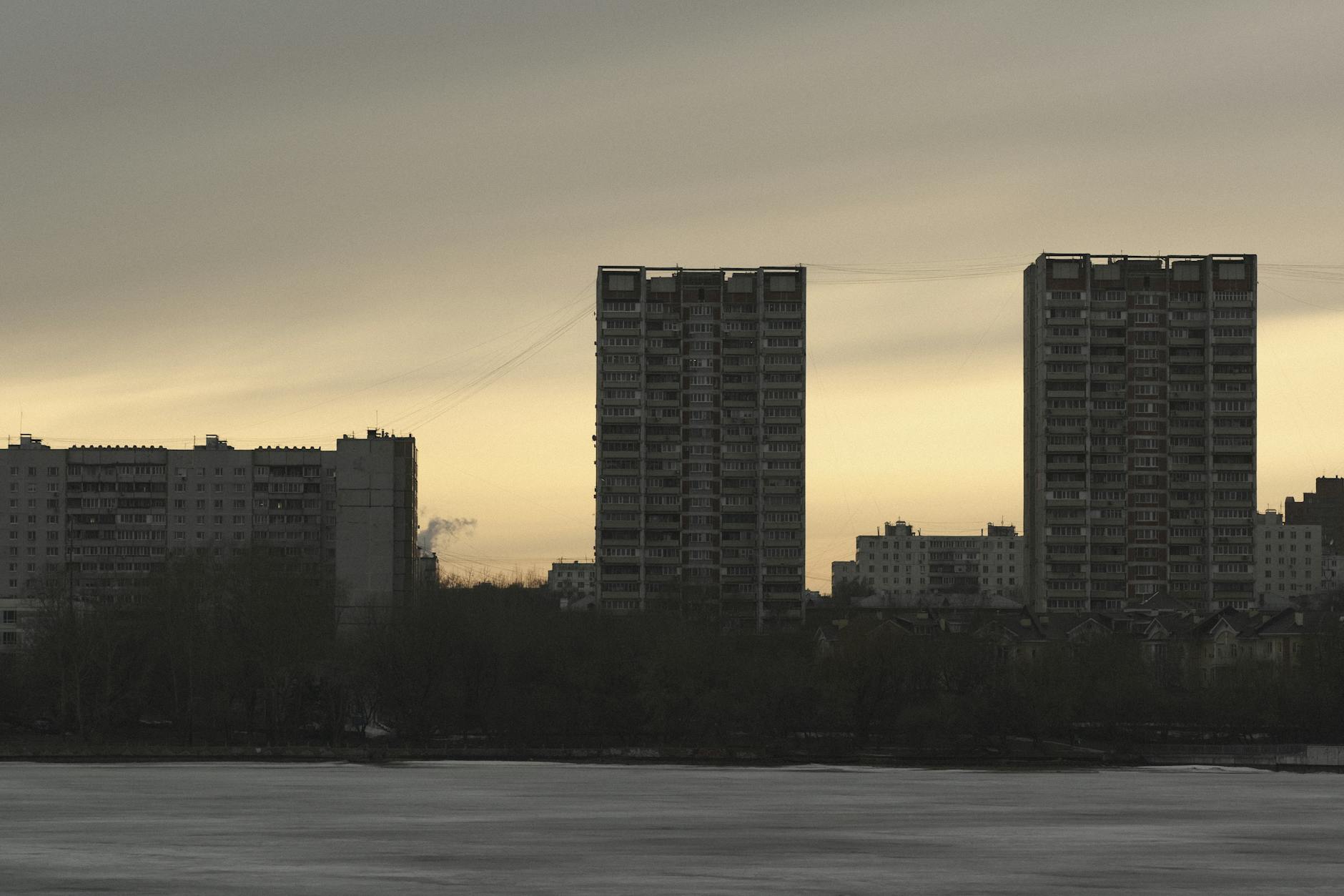
ヴォルガ川はヨーロッパで最も長い川であり、人口密集地帯を流れ、カザンからヴォルゴグラードまで、さまざまな町が点在しています。その岸辺のギャラリーには、修道院、博物館、石造りの堤防などがあります。小さな村の近くにあるブルガリア風のゲストハウスでは、穏やかな夕暮れ時の水の景色とシンプルな食事が楽しめます。主な見どころは、現代まで続く川岸沿いの文化の融合です。
レナ川は、広大なシベリアの地を流れ、巨大な流域を持ち、気候は融解と寒さが交互に訪れます。ヤクーツクのような町を通るルートは季節限定で、夕暮れの光の中でタイガが輝きます。遊牧民の商人の伝説は、いくつかの地元のギャラリーに保存されており、川下流の人口はまばらで、広大な静寂を感じさせます。手軽な寄り道として、アルグン渓谷は、小さな村の近くで瞑想的なランニングストレッチを提供します。
エニセイ川は、シベリア中央平原を切り開き、北極海へと続いています。クラスノヤルスク近くのダムは、巨大な水力発電能力を生み出しています。峡谷のブロック壁がルートを縁取り、流れはゆっくりと瞑想的になります。文化的な立ち寄りを希望する人は、川沿いの小さなギャラリーを訪れ、この地域を形作った商人や探検家の伝説をたどることができます。
オビ川は、西シベリアを流れ、オビ湾に注ぎ、その下流の三角州は、チュメニやオムスクのような町沿いに巨大な人口を支えています。川沿いの鉄道回廊はアクセスを容易にし、石造りの堤防での夕暮れは、ボートランニングの一日の後に静かな瞑想を提供します。村では、ブルガリア風の料理を味わい、地元の伝説を学ぶことができます。川は、貿易と入植の深い歴史を内包しています。
アムール川は、中国との国境の大部分を占めており、その下流にはブラゴヴェシチェンスクやハバロフスクなどの主要都市があります。川は町に幅広い人口を抱えていますが、静かな周遊路は村の田園地帯に残っています。近くの鉄道は、多くの場合、谷に平行して走り、夕暮れの散歩や石造りの埠頭への迅速なアクセスを提供します。地元のギャラリーは、かつて文化を結びつけた商人の伝説の物語を保存しており、この国境地帯が独自の文化の融合を内包していることを思い出させます。
ロシアの川:動植物
エニセイ川の三角州を夜明けにボートでクルーズし、ヨシ原、スイレン、営巣する鳥を観察してください。この早朝の光は、水生生物が川の段丘と季節的な洪水にどのように依存しているかを明確に示しています。
動植物と生息地は、洪水のパターン、塩分濃度、温度に適応します。氾濫原の地域では、ヤナギとハンノキの林が両生類や昆虫の避難場所を強化し、川岸沿いの密集したヨシ原は、魚の稚魚や水鳥の隠れ場所を提供します。バイカル地方の川沿いでは、冷たい流れが、透明で酸素が豊富な水を好むさまざまな植物を育んでいます。島や浅い湖は、スイレンやアオウキクサなどの水生植物が繁茂する場所を作り出し、コケは日陰の入り江の湿った石にしがみついています。
- ヤナギ(Salix spp.)とハンノキ(Alnus spp.)の茂みが低い堤防に沿って並び、サギ、カワセミ、渉禽類の営巣場所を提供します。
- 縁に沿ったヨシ原(Phragmites australis)は、無脊椎動物、両生類、ヘラサギを支えています。また、流れを遅くし、生産的な縁辺地域を形成します。
- スイレン(Nymphaea spp.、Nuphar spp.)は穏やかな浅瀬に浮かび、トンボや小魚を引き付け、縁に彩りを添えます。
- コケやゼニゴケは湿った石や川岸を覆い、無脊椎動物や両生類の微小生息地を増やします。
- 水生藻類と大型藻類は浅い湾でマットを形成し、カタツムリ、オタマジャクシ、内気な魚種の餌場を作り出します。バイカル湖盆地には、急速な変化に抵抗する独特の冷水植物が生息しています。
- 動物相には、東部の川のマス、パーチ、イデ、レノック、タイメンなどの淡水魚が含まれます。チョウザメは、流れが遅くなり水深が増す下流によく見られます。
- 鳥類は、ミサゴ、オジロワシ、アオサギ、ツルが中心です。ハクチョウやカモなどの水鳥は、島や湖の近くの浅瀬で餌を探します。
- カワウソとビーバーは、植生のある堤防に沿ってダムネットワークを維持します。森林に覆われた縁に沿って、キツネや小型哺乳類が夕暮れ時に餌を探します。
- 観察に最適な時期は、氾濫原が活発になり、繁殖地が見える晩春から初夏です。出会いを最大化するために、3〜5日間のルートを計画してください。
- ボートの交通量が制限された保護された湿地帯を提供するルートを選択してください。そこでは、水辺で時間を過ごし、水深の変化や生息地のパッチを観察するにつれて、快適さが増します。
- 巣からの距離に関する地域のガイドラインに従い、ねぐらになっているコロニーを邪魔しないでください。静かでゆっくりとした動きと最小限のギアノイズでアプローチを強化します。
- ギア:双眼鏡、軽量望遠鏡、防水ブーツ、通気性のある衣類、コンパクトカメラ。参照用に島と湖のクラスターを示す地図を携帯してください。
- バイカル湖の支流を訪れる予定がある場合は、より冷たい水と変化しやすい条件に備えてください。そこでは、生態系は手つかずの真実味があり、河川ネットワークへの理解が深まります。
動植物の観察をつなぐための実用的なルートがあります。保護された湾の近くから始め、流れの速さが異なる植物群落を形作る上流の支流に向かって進みます。そこでは、出会いのペースが変わり、流れの方向が種の分布にどのように影響するかを観察できます。水上での一日を、すべての水しぶきとさざ波が生物多様性の別の層を明らかにする生きた教室と考えてください。その経験は素晴らしいように見えますが、明確で測定可能であり、各停留所が明確な生息地のニッチを強調しています。時には、魚が種子の荷車を運ぶ静かな場所を見つけ、変化する深さに生命が適応する方法に驚きを感じるでしょう。そこで、私自身、何時間も水を聴き、トンボがホバリングするのを見て、光が変化するにつれてどの種が一日の中で遅れて移動するかをメモしました。
ヴォルガデルタ:主要なバードウォッチングホットスポットと優勢な湿地植物
川が広い後背地に分かれる北の土地から始めましょう。この土地には、夜明けに渡り鳥、ペリカン、サギ、カモが大量に集まり、集中的な2日間の周遊の最も強力なスタートとなります。
ターゲット:浅い湖に点在する島のクラスターと、主要な支流に沿った広大なヨシ帯。ここでは260種以上が記録されており、鳥がねぐらと餌場を行き来するため、朝と午後の遅い時間が最も活発です。
水路の水深は約0.5〜3メートルで、最も深い場所は本流の近くの広い曲がりに沿っています。淡い空を背景にシルエットで描かれたカイツブリ、カモ、渉禽類の水柱をスキャンし続けてください。岩の多い海岸はまれですが、古い土が水辺に接する場所に発生し、猛禽類やカモメに異なる止まり木を提供します。
アクセスとロジスティクス:モスクワからのフライトはアストラハンに接続し、その後、鉄道または鉄道でゲートウェイの町に接続します。ボートの乗り換えにより、島のネットワークと後背地のストレッチに移動できます。最適な時期は、浅い湾とヨシ原が生命であふれ、川の流れが毎日のパターンを定義する晩春から初秋です。夕暮れの町では、サウナが水上での長い一日の後にリラックスするのに役立ちます。
優勢な湿地植物:一般的なヨシ(Phragmites australis)の広大な群落が川岸と湖の縁を支配し、ガマ(Typha latifolia)が浅い湿地の縁に沿っています。 ScirpusとCarexのスゲがより湿った地帯を満たし、開いた湾にはスイレンのスイレンが生息しています。これらの植物は、幅広い居住者と渡り鳥に餌を与える無脊椎動物を支えています。島と静かな湾は、植生の構造がバードウォッチングの結果を直接形作る微小生息地を作り出し、人里離れたねぐらと豊かな餌場を提供します。
レナ川:タイガの植物相と川岸の野生生物観察スポット
野生生物の観察に最適なヤクーツク近くのレナ川の上の木製の展望台で夜明けに始め、タイガの端に沿って南東に川をたどり、浅い後背地のある2つまたは3つの曲がり角を選択します。これらのルートを決定したら、各停留所で何が見えるかを比較できます。
レナ川の堤防沿いの植物相は、古典的なタイガのパレットです。優勢なシベリアカラマツ、混合されたトウヒとマツ、カバノキの林、氾濫原に沿ったヤナギとハンノキの縁。晩春から夏にかけて、ブルーベリーとクランベリーの低木が縁を彩り、コケが表面の倒木を覆います。川は世界で最も長い川の1つであり、その事実が長い季節にわたって氾濫原を形作っています。
レナ川沿いの最高の展望都市であるヤクーツク、レンスク、ウスチクート、キレンスクは、アクセスとサービスを提供しています。曲がり角に沿って、ビーバーのロッジが堤防を固定します。カワウソが水面に現れ、岩の間を飛び跳ねるかもしれません。ヘラジカやヒグマなどの大型哺乳類は、夕暮れ時に氾濫原の空き地の近くに現れます。海岸線での結婚式の写真撮影でさえ、光が正しいときにはシーンの一部になる可能性があります。
観察に最適な月は、晩春から初秋までです。年に2回、渡り鳥の群れが川に沿って急増します。表面のまぶしさを最小限に抑えるために、風向きと太陽の角度について考えてください。また、開いた水域をまっすぐ横断するのではなく、曲がり角を回ってください。デルタの端の視点については、ティクシ地域と、川が本流からより広いネットワークに広がる北部の河口に向かいます。
安全性とアクセス:確立されたトレイルのみを使用してください。出発する前に、洪水のデータと地域のガイダンスを確認してください。エチケットの観点から、営巣地から少なくとも50メートルの距離を保ってください。ここでの言葉は忍耐です。ビーバーが水面に現れたり、ツルがヨシから飛び立つまで数分待つかもしれません。川のリズムに合わせると、光が変化するにつれて、本当に親密な瞬間を目撃できます。レナ川は地球規模の川の回廊の中にあり、遭遇できる最大の淡水の光景のいくつかを提供しており、各曲がりの表面は、冬から晩夏、そして再び忘れられない生命を明らかにすることがよくあります。
エニセイ川:サケの遡上と周囲の河畔植生
8月下旬から9月上旬に到着して、エニセイ川の水を交渉し、氾濫原に沿ってステージングするサケの最大数を目撃してください。平原内では、移動チャネルは季節的な洪水で方向を変え、魚をより穏やかな後背地と隠されたサイドプールに導きます。私自身、タイミングを見ており、最初の波が夜明けに到着することを知っています。水が淡い空を反射するときに簡単に見つけることができます。
河畔植生は、生息地を形作る明確な層を形成します。地表層にはコケや草が生息しています。低木層はヤナギとハンノキを保護します。上層は日陰を作り、後方の堤防に沿って水を冷たく保ちます。この明確な層化は、豊富な昆虫群集をサポートし、それが産卵場に向かうサケの稚魚と帰還する成魚を支えます。
- 観察ポイント:本流と支流の河口に沿ってアクセス可能なトレイルを選択して、複数の方向で遡上を確認し、端のプールとより深いセクションを比較します。各スポットは独自のタイミングを生み出します。
- タイミングと旅行:1回の旅行で異なる川のセクションをカバーするために、数日間計画してください。エカテリンブルクのルートからアルタイ山麓に向かい、モンゴルの水源に向かって移動し、上流のエニセイ川に供給します。
- 行動に関するメモ:晩秋には予測可能ですが、産卵床や幼魚を邪魔しないように、少し距離を置いてください。運の良い観察者は、上流の産卵を垣間見ることができるかもしれません。
- 写真撮影のヒント:遠くからアクションをキャプチャするには長いレンズを使用し、きらめく水に辛抱強く見つめ、最大限の色とテクスチャを得るには早朝に撮影します。
地域の状況:エニセイ川は、アルタイからモンゴル、そしてシベリア中央部まで流れを集め、多様な生態系をホストする回廊を形成しています。ヨーロッパの旅行者にとって、実用的なルートは、エカテリンブルクなどのハブから始まり、クラスノヤルスクに向かって移動し、川の流域に拡張します。この航海は素晴らしいコントラストを提供します。キャンプ場で地元のグループの伝統音楽を聴いたり、海岸沿いのホストに会ったり、コミュニティが独自の文化的慣習の中で川の景観をどのように管理しているかを学ぶことができます。川沿いには静かな観察のための多くの展望ポイントがあります。
オビ川:氾濫原の生息地、哺乳類の回廊、およびアクセスポイント
春に訪問を計画し、サレハルド川ターミナルから始まるガイド付き旅行のチケットを予約してください。これにより、オビ川沿いの氾濫原の生息地と哺乳類の回廊を観察するための実用的なルートが提供されます。
これらの氾濫原の生息地は、下流に数百キロメートルにわたって広がり、きれいな水路、ヨシ原、ヤナギの茂みの曲がりくねったネットワークを形成しています。回廊は、より大きな森林ブロックと多数の湖を結び付け、ビーバー、カワウソ、ヘラジカ、ノロジカ、オオカミの群れ、および小型の肉食動物にとって簡単な移動ルートを作成します。春には、水位が上昇して平原全体に広がり、その地域は美しくもダイナミックになります。動物の活動の兆候は、野生生物がこれらの空間をどのように使用しているかを明らかにする足跡や餌場が堤防に沿って現れます。景観は寒くても生きているように感じられ、暖かさと光に突然道を譲った凍てつく冬とは対照的です。ロシア人は、地面がまだ湿っていて硬い場所でも、空気が予想よりも暖かいと感じることがよくあります。
そこでは、景観の形が実用的な探検をサポートしています。ボートまたは徒歩で湿った氾濫原のブロックに沿って移動し、大型哺乳類が季節的な餌場に到達するために使用するルートをたどることができます。これらのネットワークは自然の地下鉄に似ており、主要な生息地を数百メートル隔てていますが、長距離の移動には十分な接続性があります。訪問者は、肉の食事が長旅の間に素朴でシンプルな性格を帯び、食事休憩が動物の活動のピーク時に合わせて行われることに気づくことがよくあります。そのような瞬間は、グループのダイナミクスとうまく調和し、友人や家族のグループにとって記憶に残る社会的な経験を生み出します。
バイカル湖の湖が支配的な風景や、より広いアムール森林システムと比較して、オビ川の氾濫原は、より密集した哺乳類の回廊と湿地の曲がりくねったモザイクを提供します。そこでは、本物の川の生活が、開いた水域、ヨシ原、低木を通して展開され、予想以上に近くに感じられる多様な鳥や哺乳類を支えています。春の訪問は、足跡と冬の最後の痕跡を見るのに最適な機会を提供し、いくつかの種が解凍を利用して平原を急増します。アクセスポイントは川の下流に沿って広がっており、選択したルートと水位に応じて、車、ボート、または鉄道でアクセスできます。快適なペースで計画し、急がないでください。この経験は忍耐と注意深い観察に報います。
実用的なメモ:可能な場合は事前にチケットを購入し、地元のガイドとのアクセスを維持するためにグループのサイズを適度に保ち、モバイルベースから近くの湿地帯に移動できる数日間の旅程を検討してください。涼しい朝や暖かい午後など、変動する天候に備えて荷物をまとめてください。長い一日の後のサウナでの休憩は、歓迎されるリセットを提供します。湖や小川の中を歩く時間を残し、高原での広大で澄んだ空気の感覚を楽しんでください。山々の近くには、水が後背地にゆっくりと流れ込み、突然広い牧草地が開けるルートがあり、いくつかの写真撮影の機会と、地元のガイドから哺乳類の行動について学ぶ機会を提供します。
| アクセスポイント | 最寄りの都市 | 典型的なルート | 最適な季節 | 注目すべき野生生物 | 実用的なメモ |
|---|---|---|---|---|---|
| サレハルド川ターミナル | サレハルド | 氾濫原に沿った水上セグメント。完全な川を最初に体験するには、ここから始めてください | 春の洪水(4〜5月) | ビーバー、カワウソ、ホッキョクギツネ、ヘラジカ | 早めに予約してください。ターミナルでチケットを購入してください。氷の漂流のリスクに備えてください。暖かいレイヤーを携帯してください |
| オムスク川港 | オムスク | オビ川下流の回廊。平行な水路とヨシ原。日帰り旅行または短い宿泊 | 晩春から初秋 | ノロジカ、オオヤマネコの兆候、ビーバー | 道路でアクセス可能。小規模なグループに実用的。数メートルの水が平地を覆う可能性があります |
| ノボシビルスク川岸 | ノボシビルスク | 右岸に沿ったクロスストリームルート。市内の博物館への訪問と組み合わせます | 5〜6月 | ヘラジカ、キツネ、さまざまな水鳥 | 数日間のオプション。安全のためにガイドを手配してください。公式ツアーにはチケットが必要です |
| バルナウル川岸 | バルナウル | 西向きの氾濫原ループ。川のフェリーで市内からアクセス | 6〜8月 | ビーバーコロニー、カワウソ、鹿 | 大規模なグループに適しています。トレイルでの長い一日の後に、ウォームアップサウナの停留所を計画してください |
アムール川:トラの回廊、森林の端の植物相、および訪問する保護地域
アムール川の南東回廊に沿って4日間の訪問を計画し、トラの回廊、森林の端の植物相、および責任あるアクセスを許可する保護地域に焦点を当てます。アルグン渓谷の近くに滞在し、地元のレンジャーと連携し、生息地を永遠に手つかずの状態に保つために、足跡を完全に保ちながら注意してください。夜明けから夕暮れまで、朝は澄んだ川岸で始まり、夕方は静かな森の音に消えていきます。
トラの回廊は、獲物が集まる氾濫原と島に抱きついています。そのため、アルグンからアムール川の長い曲がりに沿って北に向かいます。足跡はほとんど単独で泥の中を走り、時には足の長さまであり、成熟した猫の活動を明らかにしています。常にマークされたパスにとどまってください。コアエリアを邪魔しないでください。幼獣との安全な距離を保ってください。捕食者が近くにいると、鳥の大群が飛び立つことがあります。
森林の端の植物相は、川面に沿った純粋で澄んだ微小生息地で繁栄します。南東のリーチには、高いカバノキ、マンシュウアッシュ、ヤナギの縁があります。島や堤防に沿って、シダやコケが無限のカーペットを形成しています。美しさはすべてのそよ風に感じられ、この端の生息地が永遠に生命を支えていることを思い出させます。
含める価値のある保護地域:ラゾフスキー自然保護区、ゾフティグロボイ保護区、およびビキン国立公園。入場には公園管理からの許可が必要です。タマラや他の監視員に相談して、安全なルートを手配してください。川の旅行は一般的ですが、鉄道リンクはいくつかの町を結ぶことができます。現場では、マークされたトレイルに従い、大きな音を立てるのを避け、植生を損傷しないでください。そうしないと、見に来た高い生物多様性を損なうことになります。
目撃に最適な月は5月から10月までです。冬は長く寒くなりますが、天候が許せば一部のルートは開いたままになります。軽量のレインギアとブーツを持参してください。ほとんどの蛇口では水は純粋で安全です。村での短い休憩は、地元のワインを一口飲み、トレイルでの長い一日の後に休憩する時間を提供します。この経験は、川岸から森の高い樹冠まで、本当に美しく、ほとんど無限の地平線まで、永遠にあなたと共にあります。


